Transportation planning in the US gaining momentum with GoodVision
Who’s behind WSB and how it all started
It’s been 2 years since GoodVision started cooperating with the U.S.-based company WSB. Operating for almost 30 years, WSB is a design and consulting firm with expertise in engineering, community planning, environmental and construction services. Finding a company that shares the same vision as we do is not always easy. In this case, we both aim at making cities a better place for people to live, by improving transportation and our environment.
For GoodVision, working with Do Nam, WSB’s Director of Traffic Modeling and Technology, and his team of professionals was a challenge and a pleasure at the same time. They were experienced with collecting data using emerging technologies and translating it into useful information, to be later applied to projects related to Transportation Systems Management and Operations (TSMO) and safety in transportation.
Since the beginning, processes have always been streamlined at WSB. Before applying any new technology or collecting traffic data, their team ensures the project goals and objectives are clearly defined in advance. They are fully aware that data sources have various strengths and weaknesses, and that the best source of data for one task may not be as valuable for a different kind of task.
Before working with GoodVision, the team thoroughly evaluated all benefits and drawbacks of data sources to understand the potential applications and limitations and to select the best source of information needed for their projects.
A new way of collecting traffic data for reliable results
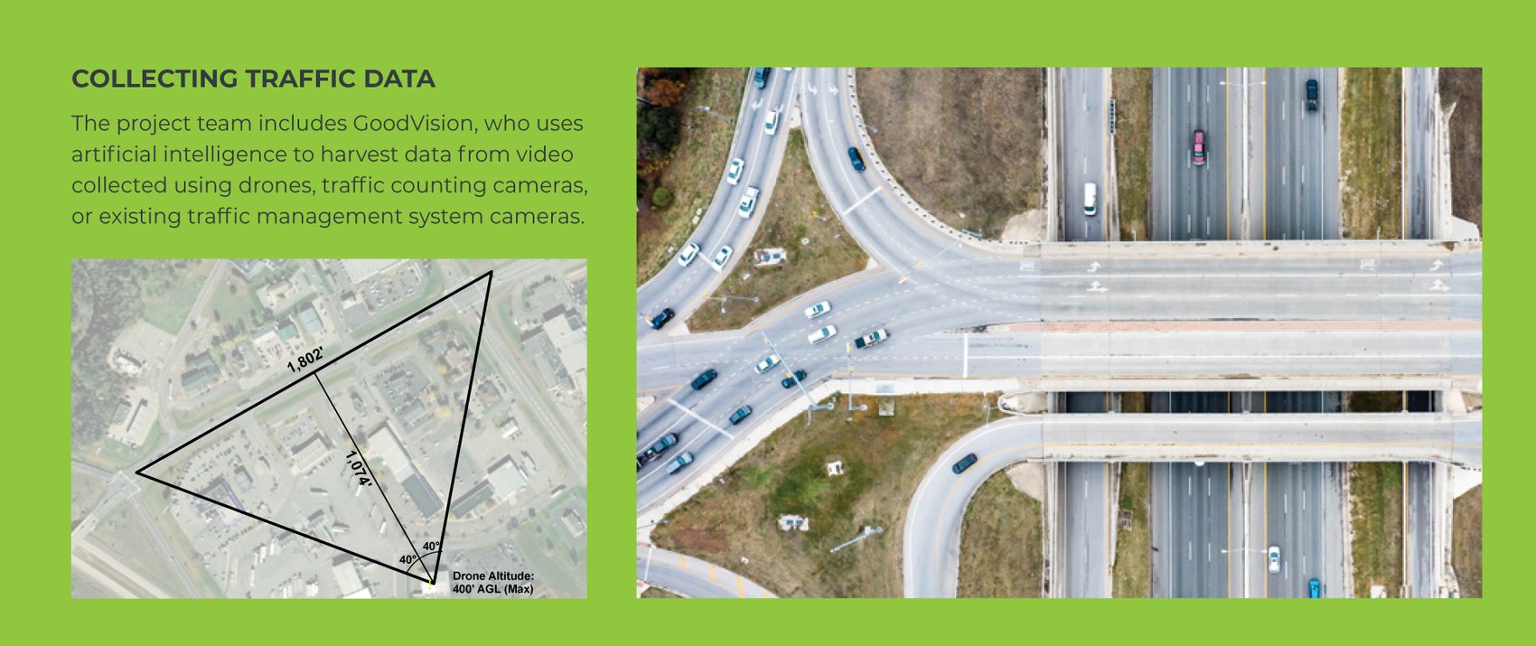
The WSB team chose GoodVision as our AI-based solution was best able to harvest data from video collected using drones, traffic counting cameras, or existing traffic management system cameras.
For years WSB has been welcoming emerging technology to advance solutions for various transportation needs. They were convinced of using GoodVision only after recognising our innovative and practical approach to collecting traffic data using video processed with AI and detecting real-time traffic events with edge computing. Since then, they have successfully implemented advanced data collection techniques in various transportation projects for the Minnesota Department of Transportation (MnDOT), ranging from freeway systems management and operations studies to freeway/arterial corridor design/build projects, and work zone management up to asset management.
WSB understands that automated traffic data collection is helpful only when translated into clear and reliable information, easily applicable to decision-making. The teams have developed procedures to verify data quality and account for any outliers or errors in data collection. They always ensure that the information and context of the data are understood by all parties before interpreting such data and drawing any conclusions.
Examples of successful implementation towards regional mobility goals
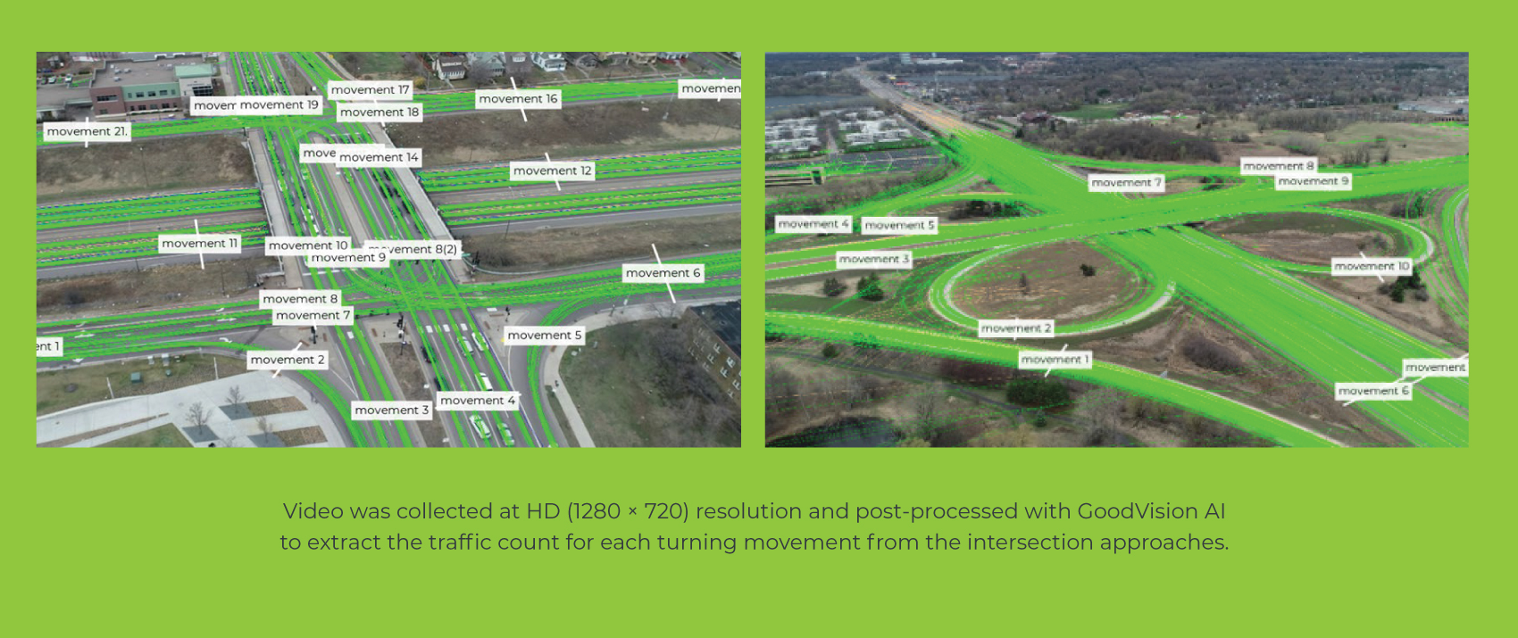
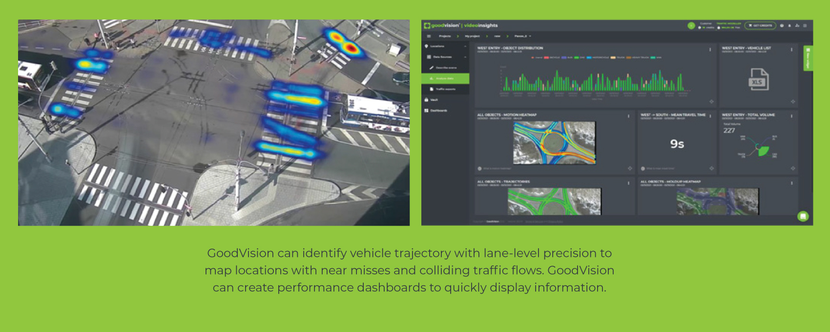
WSB was impressed by GoodVision’s ability to identify vehicle trajectory with lane-level precision to map locations with near misses and colliding traffic flows. Time is precious for everyone, so they appreciated the possibility to create performance dashboards to quickly display information and react accordingly.
The information gathered from processing the traffic data collected is put to work toward pilot projects supporting regional goals for safety and mobility defined in MOMENTUM - the long-term transportation plan for the MAG (Maricopa Association of Governments). It aims to build a meaningful connection between data collection and planning, using the data obtained to create relevant performance measures and progress toward regional policy goals, thus helping prioritise investments.
The first case where WSB used GoodVision’s solution successfully was the Metro Work Zone Capacity Study and Model Improvement Project. Throughout the project, the team collected traffic data in various work zones throughout MnDOT’s metro district. The information gathered provided an accurate depiction of traffic delays during construction. In the past, this type of data collection has been time-consuming and expensive. With GoodVision, the team was able to collect the data and streamline processes efficiently and effectively. Recently, they applied for federal funding that if awarded, would allow them to collect similar work zone capacity data across the U.S.
In addition, the WSB team is using GoodVision’s solution on the Trunk Highway 10 project in Moorhead, Minnesota. MnDOT is evaluating the impact of reconfiguring a heavily travelled intersection from four lanes to two lanes and the traffic impacts that may occur. To gather the data, the team set up a demonstration using GoodVision’s solution. They are currently in the process of analysing the data and will provide traffic congestion feedback to the DOT.
The data obtained will heavily influence the decision to reconfigure the congested intersection. And this is the true power of traffic data analytics. With 100% verifiable data, you can make better recommendations and deliver better, more accurate information to help decision-making.
Traffic Safety and Plans for Sustainable Mobility
WSB was aiming to proactively identify high-risk locations that did not have a crash history yet. They managed to do so with GoodVision as the solution can identify conflicting vehicle paths and near-misses, including bicyclists and pedestrians. They realised the technology could be applied at specific locations to predict risky vehicle manoeuvres that affect people’s safety, such as pedestrian detection, work-zone near-miss events, and wrong-way driving events.
With such a piece of knowledge about high-risk crash locations in hand, WSB was ready to help prioritise needed safety improvements and respective investments. GoodVision video analytics solution allowed the accurate determination of saturation flow rates at specific locations. This in turn is being used to improve the accuracy of work zone capacity for modelling. Moreover, O-D from video using the software solution can be implemented for complex turning movements that simply can’t be captured in an ordinary turning movement count.
Counting cameras were placed along the project corridor to collect video for processing with GoodVision and a drone video was used to measure queue length. The resulting work zone traffic capacity measurements significantly improved the accuracy of work zone traffic modelling.
About Do Nam, PhD, PE
A few words are worth mentioning about our main point of contact, Do Nam, Director of Traffic Modelling and Technology. He’s been well known for years for his openness to new technology, using state-of-the-practice large-scale traffic modelling and innovative technology for data collection and analysis. With over 25 years of experience, he has successfully managed major transportation and research projects in the USA and Qatar.
He has developed a traffic operations modelling practice by integrating traditional travel demand and microsimulation traffic modelling techniques, implementing emerging technologies such as Big Data and Artificial Intelligence (AI). From the very first moment that we met, there was a clear understanding he was passionate about his job, and strongly believing in his mission.
Read more success stories of our clients
- Using tethered drones for traffic surveys in Singapore
- Real-Time Traffic Monitoring for Congestion Prevention
- Driver behaviour analysis in Spain with Vectio
- Transport planning in Warsaw with IDOM
- Mobility planning with A+S
- Traffic Surveys in the UK with A-T-R
- Automated traffic data collection with CzechConsul


